Falls Creek Accommodation & Activity Maps
Falls Creek is located high above the Kiewa Valley in North East Victoria. Falls Creek’s weather is as unique in Winter as it is in Summer!
*** Please note that the Bogong High Plains road from Omeo to Falls Creek is NOT OPEN in winter. You must access Falls Creek via Mt Beauty. ***
 |
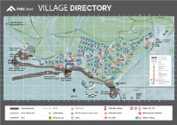
Village MapClick to view a PDF of the Falls Creek Village Map (open in a new tab) which includes a legend identifying the various businesses and key locations around the Village |
 |
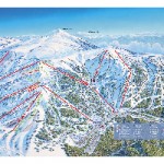
Alpine Trail MapThe Falls Creek alpine trails combine stunning views with iconic tourist landmarks and heritage sites. Click to view the Falls Creek Alpine Trail Map. |
 |
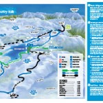
Cross Country Trail MapThe Alpine National Park offers gorgeous cross-country hiking trails. View a range of stunning landmarks, historic sites and get close to the local wildlife. Click to view a PDF of the Falls Creek Cross Country Trail Map. |
 |
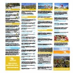
Summer Activity & Event Guide and Walking/Cycling MapsExperience Falls Creek in Summer and enjoy our beautiful alpine weather! The Falls Creek Summer Guide will show you all the amazing places where you can start an adventure around the village or in the Bogong High Plains. |
Falls Creek is a great place to visit at any time of year! Although it’s best known for ski trips, snowboarding holidays and winter accommodation, there are some great summer activities that make it worth considering summer alpine accommodation at Falls Creek too. Check out our on-mountain apartments and contact us for a quote.

